Bel Ombre trailhead at Plaine Champagne
Starts at 716 meters / 2350 feet above sea level. Ends at sea level.

The Bel Ombre trailhead is on the left side shortly after Plaine Champagne Police Post (going from Petrin to Chamarel)

After a couple of bends the landscape opens up and this is WOW!
View to the South coast.

Cocotte mountain (771 metres / 2529.5 feet)

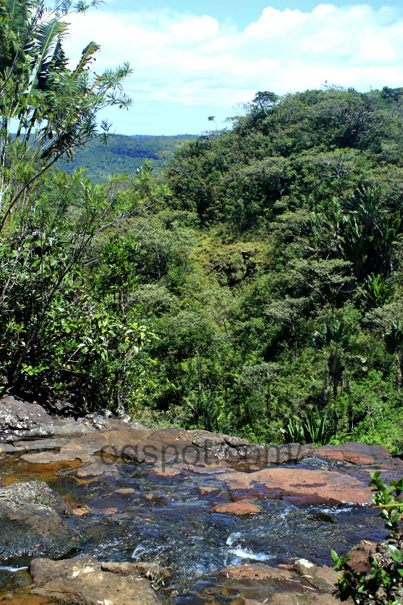
Scenery along the trail

6 km (3.7 miles) done, 8 km (4.9 miles to go)!
Still a long way to go....

The trail is mainly a 4WD track, easy walking.


Savanne mountain range


View towards Bel Ombre and the South coast

The first gate that has to be open and closed
Entrance to Black River Gorges National Park (from Bel Ombre).

We had a rest next to the gate and discovered some stags grazing (one of them next to the tree)

Just after the second gate (gate was open) there's a stone on the right side that points to Bon Courage.

Being on totally unknown territory, it was on a Sunday and no one to ask for direction, we were not sure either to walk towards Bon Courage or follow our intuition; straight ahead towards the sea.

View towards Black River Gorges National Park


Baie du Cap

Baie du Cap
Waiting for the BDCap - QB bus
A great hike on unknown (to us) trails.
Starting point: Ganga Talao @08:40
Baie du Cap @16:30

The first gate that has to be open and closed
Entrance to Black River Gorges National Park (from Bel Ombre).

We had a rest next to the gate and discovered some stags grazing (one of them next to the tree)

Just after the second gate (gate was open) there's a stone on the right side that points to Bon Courage.

Being on totally unknown territory, it was on a Sunday and no one to ask for direction, we were not sure either to walk towards Bon Courage or follow our intuition; straight ahead towards the sea.

View towards Black River Gorges National Park

We decided to head towards the sea.
Roads inside sugarcane fields go in all direction and it is easy to get lost if one doesn't have a sense of direction. Luckily the sugarcane were harvested! Great views in all directions.

Pineapple field along the trail

After 45 min walk (from second gate) on sugarcane field trails, we have reached civilisation; Bel Ombre coastal road!

Bel Ombre public beach


Kids playing at the beach in late afternoon sun


Dogs having fun at the beach too!

Cutest, and one of the smallest post offices on the island; Baie du Cap Post Office

Cutest, and one of the smallest post offices on the island; Baie du Cap Post Office

Baie du Cap

Baie du Cap
Waiting for the BDCap - QB bus
A great hike on unknown (to us) trails.
Starting point: Ganga Talao @08:40
Baie du Cap @16:30